
Having sweated it out yesterday, today is fleece weather, albeit with shorts. It's the kind of day where it isn't too bad if you keep moving but when you stop to admire the scenery in an exposed spot, you don't stop for long. I prefer it to the heat of yesterday, but Dave, my brother-in-law and walking companion, isn't so sure.
Like yesterday, the first part is easy walking and downhill, first through woods and then across fields as we head towards Stroud, in particular Ebley. Today we are faced with a choice. At the bridge pictured below we can carry on across and take a shorter route, or we can turn left once we have crossed the bridge and walk along the Stroudwater Canal. (If you are using this blog to pick up anything practical for your own walk (heaven forbid!) then it will be useful for you to know that the picture is taken once you have crossed the bridge, looking back to your right.) Do note that neither of the two options are signed as the Cotswold Way and, unusually, there is no signage on the longer route until we reach the A419.
Both routes are equally valid and recognised and official but I don't want to feel I have taken any shortcuts. I am so obsessive about this that I even walked an extra fifty yards to the end of the car park yesterday in case I parked closer to the entrance to the woods this morning and missed twenty yards somewhere. So it's the longer option for us. Along the canal and over Selsey Common.

Now, of course I don't know what we missed on the other route but I strongly suspect we made the right decision. For a start we had some flat walking alongside the Stroudwater Canal and the team who are devoting their efforts to it's restoration are clearly seeing some great results. Unknown to us, just up (or down) stream at Stonehouse, the first of the boats for the Jubilee celebrations is being lowered down the slipway today. I didn't realise the significance of this until I later read that the boats taking part in these celebrations were the first to take to the water in a hundred years. This also explains the big voluntary work party, out in force, busy making final preparations.


The climb up to Selsey is across a field and as well as pausing to work out how the village plays on such a hilly cricket pitch, we call in at Selsey Church to admire the windows. It's a Victorian building with windows by some of the Arts and Crafts movement, William Morris designed some of the windows.


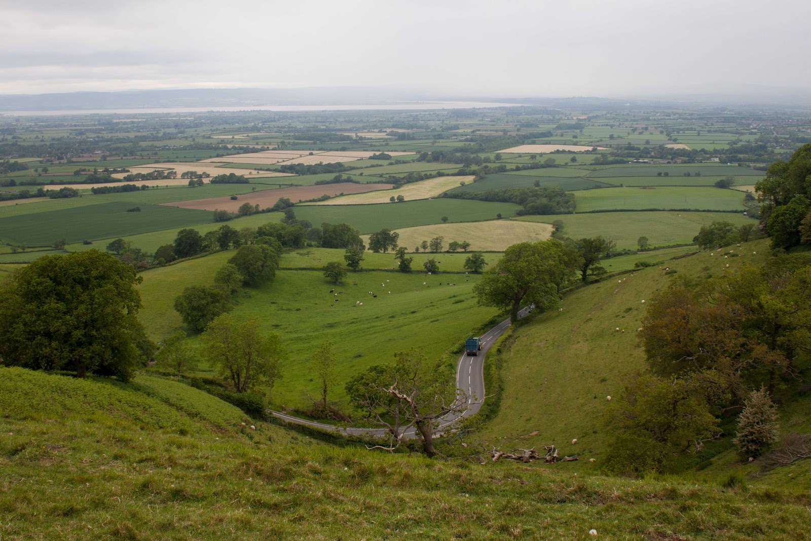
The climb up to Selsey Common is a longish and steady one and, with a few breaks to take in the scenery, not too taxing. Not bad considering we have climbed from around 30 metres at canal level to over 200 metres. The views are great across Selsey and the church, and the Stroud Valley beyond it.

Once over the common we seem to spend a lot of time in woods, going down and up. I don't like the thought of the height I am giving away after the ascent of Selsey Common, knowing we'll only have to climb again. Those hills, they make you pay! Eventually we emerge at the Nympesfield Long Barrow and soon after that to Coaley Peak. It's very windy up there today and the last of the fruit (or food of any kind) that we have is consumed in haste so as to move on.
And now for my confession. We made two mistakes today. One was to use an old OS map that showed us a Car Park that isn't on the current map and I can't see exists anymore. This was especially dumb as I had the newer version as well, tucked away in my glove compartment. Why? Instead of parking there as planned, Dave (and this will be no surprise to anyone who knows him) suggested that we parked opposite the pub in Uley, leaving us a walk of about a mile downhill to get there but with a great incentive.
The second mistake was a shared one. We were both so excited (in a, 'Well, we've come this far, let's take this hill as well' sort of way) that we see Cam Long Down and it's short sharp climb as a challenge. It's hard work this late in the walk but the views are good. What we don't realise (and Dave doesn't know yet) is that we didn't need to climb it at all. I needed to on Day 7, but he got to climb it in what I like to consider a bonus. Time will tell if he agrees. I may not tell him yet as he is considering walking another leg with me. maybe later.

Coming down the other side we meet a runner who tells us, without breaking stride, that we need to leave the trail here and head back down the road. Particularly impressive as earlier we saw him run up the hill we have just laboured up. It's a longer walk than is necessary to get to Uley village (we are on the edge of Dursley when we turn back) and we have walked further than planned today. But the Uley Ale, brewed in the same village, is fantastic and Dave's decision to park opposite the pub is more than vindicated. Next time I am faced with the choice of parking in Dursley and walking back to where we left the trail before we turned back or starting in Uley, parking outside the pub again. It's a tough choice.

No comments:
Post a Comment